All about GPS receivers, Coordinates, Maps and Smart Phones
This page explains all about your GPS; how it works, the features on it, satellites and coordinates and how to decide which one to buy. You'll also find information about the maps the GPS can use as well as using a smart phone for caching.
| The basics - the GPS satellite system explained | |
| The basics - different types of GPS available | |
| The features of a handheld GPS for geocaching - receiver, compass, waypoints & more | |
| The features of a smart phone for geocaching - receiver and compass | |
| All about coordinates and map datums | |
| How the GPS receiver picks up satellites; accuracy and WAAS and EGNOS explained (simply!) | |
| What maps can you use on a GPS receiver? Can I create my own? | |
| What maps can you use on a smart phone? | |
| Which handheld GPS is which? How do I choose one for Geocaching? Comparison table of Garmin and Magellan | |
| Garmin and Magellan information. Wikis and forums - a wealth of information, hints and tips from other users |

![]() Back to top of page
Back to top of page
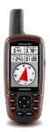
| Basic Handheld GPS These provide basic navigational functions and have a compass. They do not support maps. Limited number of waypoints and routes. Can be connected directly to a PC but may need a special serial cable (eTrex H). With the exception of the eTrex 10 these GPS's are not 'paperless', that is you cannot download all the cache information to them other than basic cache GC number and coordinates. Examples: Garmin eTrex and eTrex H, Garmin GPS60, Garmin eTrex 10 |
   |
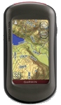
| Mapping and Paperless Handheld GPS Same navigation functions as the basic models but support maps allowing you to see in varying detail where you are. You can display routes and waypoints on the maps. They have the ability to download cache information so you don't need to print out cache pages. The information is the same as you see on the web page, description, hints, logs and waypoints*. The paperless GPS receivers nearly all have greatly increased memory (external microSD card) allowing more maps to be stored and a considerable increase in waypoints (caches). They mostly have an electronic compass and usually an altimeter. Some models are 'touch screen' which makes entering data much easier. PC connection is easy via a USB cable so you can transfer cache information from the web page quickly. Examples: Garmin eTrex 2x series, 3x series, Magellan GC, Garmin GPSmap60, Garmin GPSMap 62x, Garmin Montana 6xx, Oregon 6xx, Garmin Oregon 5xx, Garmin Monterra, Magellan eXplorist 710 (also 610, 510, 310) *Paperless features are only available to Premium Members. |
        |
| Smart Phone Many phones have a built in GPS receiver and you can install software to let you use the GPS for geocaching. You may also be able to store/run maps as well. Generally they behave as a 'handheld' GPS receiver but there are limitations such as poor battery life and ruggedness. Certain smart phones have specific apps available for geocaching. These are explained later on this page. Examples: iPhone (IOS), HTC (Android) |
  |
| Car Sat Nav These are specifically designed for use in a vehicle. They can be used for geocaching but it is not always easy. For example a handheld GPS (or phone application) shows you a compass arrow to follow and a countdown of the distance to the waypoint. This may not be available on a sat nav. Battery life is another issue as you can only expect a few hours time outdoors. Examples: TomTom and Garmin Nuvi |
|
![]() Back to top of page
Back to top of page


Connecting to a PC: To transfer data to your GPS from your PC you need to connect it. The basic models (Garmin eTrex H and Geko) have a serial connection which needs a special cable - not usually supplied with the GPS. The other Garmin and Magellan units all use a simple USB connection. You can copy cache information from your browser to the GPS. If you are a premium member with a Garmin or Magellan paperless GPS then you can transfer the data directly to the GPS in one simple operation - up to 1000 caches at a time using a Pocket Query.
|
 Serial cable used on the eTrex and eTrex H and Gecko |
 USB connection used on most other GPS receivers |
The Features of a Smart Phone for Geocaching
The iPhone and Android phones all have dedicated applications you can use for geocaching. These allow you to find caches, download cache information and log your finds online. The apps are available from the respestive online stores.
Smart phone GPS receivers are now quite sensitive and suitable for geocaching. Adding waypoints and navigating to them may be less easy than with a dedicated handheld GPS. Don't forget your 'smart' phone is also your MP3 and video player, web browser, email application and much more. The compass and GPS are just additional applications. A handheld GPS on the other hand is designed for really only one job, navigating.
The geocaching applications are fine for finding caches but when you place a cache you need to record the coordinates accurately. The smart phone uses both the GPS and the mobile radio signal to determine its position (triangulation). If you have a poor GPS signal you may not know how inaccurate it is. This is determined by the GPS chipset in the phone. This article in the Help Center explains how to use the apps to find your location and display the coordinates. Please be aware though that when first opened the application will NOT be accurate. Leave the phone with a clear view of the sky for a minimum of 5 minutes to ensure it gets a good satellite lock. When recording coordinates you should walk to the cache site from several directions and from about 30 to 50 feet (10 to 15 meters) away each time and then average the readings to get them as accurate as possible.
![]() Back to top of page
Back to top of page
Coordinates and Map DatumsLatitude and longitude have been around a long time (since people first started to sail the oceans basically) and refers to the lines going from pole to pole (longitude) and round the equator going up to the north pole and down to the south pole (latitude). Longitude is measured from the Greenwich Meridian which is 0 degrees east and west and Latitude from the Equator which is 0 degrees north and south. There are several different formats to use and different countries produced their own version including the United Kingdom with the Ordnance Survey British Grid. To get some standardisation various countries got together to produce the map datum World Geodetic Survey of 1984 (WGS84) which is currently still valid. Have a look at this Wiki article which explains why we have and use this standard.So based on WGS84 we use Lat and Long which can be written in several different ways. Why? Because we can and you can use whichever you want! To give you an example, this is the junction of the M4 and M5 motorways near Bristol in the various formats: British Grid ST 61785 83780 They all get you to the same point but for consistency its best to just
use one. Geocaching use Degrees and Decimal minutes on the WGS84 map datum
and this is what your GPS should be set to.
See the screenshot below from an Oregon GPS. So if you are talking geocaching to a fellow geocacher wherever they
are in the World they'll understand where you mean because we all use
the same coordinate notation. If you want to use your GPS with the position format of British Grid (Ordnance Survey) then make sure you change the Map Datum to Ordnance Survey. Similarly if you change from Ordnance Survey back to Lat/Long HDDD° MM.MMM then check the map datum is WGS84.
If you end up with the coordinates on one format and the map datum on the other you'll find your GPS is incorrect by about 300 feet (100 meters). This is the settings screen from an Oregon GPS. From the settings menu, open the Position Format menu then you can change the Position Format and Map Datums. Screenshots of both settings (Lat/Long Degrees and Decimal minutes and the British Grid Ordnance Survey) are shown. |
 |

What maps can you use on a GPS?
Both Garmin and Magellan produce maps for their GPS receivers. There are 'Topographical' and 'Street' map versions available. The topographical maps (also referred to as 'topo') show features of the countryside such as rivers, woodland, footpaths etc. Street maps are just that with few topo features showing. On the more expensive GPS receivers these maps usually support turn by turn routing for navigation by car, bike or on foot. Maps may be included with the GPS model or available to purchase separately.
All Garmin and Magellan GPS's that support maps, come with a Base Map which in the case of Garmin is very basic and not much use. The Magellan Base Map is much more detailed.
Ordnance Survey maps
Both Garmin and Magellan produce Ordnance Survey (OS) maps for the UK (and Northern Ireland and the Republic of Ireland on Garmin). These are based on the 1:50000 scale Landranger maps and 1:25000 Explorer maps (includes national parks). These OS maps are very detailed but are very expensive.
Open Street Maps (OSM) - Garmin only, these do not work on a Magellan GPS
OSM maps of many parts of the World are available from various sources and these are quite easy to install on the GPS. A UK geocacher, TalkyToaster has created a series of maps for the British Isles and Ireland that are based on OSM and these have the look and feel of the OS maps. These are very detailed and a very cost effective alternative to the Garmin OS GB Discoverer maps. There are several versions available and are very reasonable priced. You can either download them or buy a pre-loaded microSD card. Full details are on TalkyToasters website.
Note: TalkyToasters OSM maps are also available to run on the PC and in Garmin's Basecamp software.
![]() TalkyToaster's Open Street Maps.
TalkyToaster's Open Street Maps.
Maps on a Garmin GPS
![]() See details of the available maps including comparison of the maps with a series of screen shots (opens a new page)
See details of the available maps including comparison of the maps with a series of screen shots (opens a new page)
Maps on a Magellan device
![]() See details of the available maps including screen shots (opens a new page)
See details of the available maps including screen shots (opens a new page)
Create your own maps
Please note that the Ordnance Survey digital maps with the PC programs Memory Map, Anquet and Fugawi cannot be transferred to a Garmin or Magellan GPS though you can use the maps on the PC to transfer and load routes and waypoints from the map to the GPS. There are software applications available that allow you to 'capture' these maps from a PC map program (or scanned maps) and copy them to the GPS. This can be quite a time consuming process.
How are maps stored on the GPS?
Maps are stored in the GPS memory. Most GPS's come with more than sufficient internal memory and all the newer ones support microSD cards for additional storage. Some GPS's come with pre loaded maps. See the comparison table later for full details of this. Pre-loaded maps use an additional area of internal memory and doesn't affect the normal memory available for you to use. A 2Gb microSD card is sufficient for TalkyToasters Open Street Maps.
The topo and street maps from Garmin and Magellan and the free Open Street Maps are vector based which means you can zoom in very closely without losing any detail. Both the Garmin and Magellan Ordnance Survey maps are raster based which means they go a bit 'fuzzy' if you zoom in too closely. For this reason it's best to have both the OS (or OSM OS style maps) on your GPS. You can easily switch between them. Magellan in fact auto-zoom the maps from the OS to the Base Map.
![]() To load various map types to a GPS/PDA/Phone
To load various map types to a GPS/PDA/Phone
![]() Garmin website
Garmin website
![]() Magellan website
Magellan website
![]() Back to top of page
Back to top of page
What maps can you use on a Smart phone?
All smart phones have map applications available, such as Google maps. The geocaching applications you buy also use maps. These are however run 'online' so you will need a data connection to use them. You can also purchase from Memory Map the application to run Ordnance Survey (Landranger series) maps you have with the Memory Map application on your PC locally on the phone without a data connection. If you don't have Memory Map on the PC you can buy the maps for the phones. See the Memory Map website for details. For the iPhone the Motion-X GPS application allows you to download Open Street Maps to use offline.
![]() Memory Map website
Memory Map website
![]() Back to top of page
Back to top of page
Which handheld GPS is which? How do I choose one for Geocaching?
There are a lot of different handheld GPS receivers available with many different options. In the table below I've tried to give the main features as discussed further up this page to help you choose which GPS is the best for you based on the features you want and the price. A great way to find out about different types is to go to a Geocaching event and talk to other geocachers and have a look at what they use and what their preferences are. The Geocaching Association of Great Britain have a Calendar of events coming up.
The 'paperless' GPS units hold both waypoints and geocaches separately. This greatly increases the number of caches you can store and also keeps them separate to make it easier to go geocaching. You should also read the page in this site about paperless caching to understand more about how it works and how the cache information is sent to the GPS units. To get the full benefit of paperless caching you need to be a premium member of geocaching.com. There are also a huge number of forum posts from people trying to compare units and find the best.
![]() Paperless caching page
Paperless caching page
![]() Forum posts about GPS's
Forum posts about GPS's
![]() GAGB Event Calendar
GAGB Event Calendar
The GPS units listed below are all current models. There are other models but the list would be just too long! The ones listed here seem to be the most popular that geocachers use. There are also very old discontinued models but I've not shown those either. Some more recently discontinued models (like the Oregon 4xx) are still available from some places and are still very popular. These are in the table in italics. The guide price is just that, a guide. You should shop around for best prices. Be careful of deals that offer maps with the unit. Check which maps are included in the deal.
All the Garmin mapping GPS's come with a 'Basemap' which is not a lot of use having only very basic road coverage which isn't very accurate.
The features listed here are the key ones. The units have many more features so you should check Garmin's product page for complete details. Other features (not shown) include dual battery,altimeter, route navigation etc.
All GPS's listed have a straightforward USB connection to a PC except the eTrex H which needs a special serial cable which is not supplied with the unit.
Disclaimer: All the information provided here is for information only to help you make a choice and I take no responsibility for any omission or errors. Please visit the Garmin & Magellan websites for full specifications of each unit.
| Garmin GPS |
| Device | Touch Screen |
Paperless Caching |
Geocaches | Waypoints | Internal Memory |
microSD Card | Maps | Pre-loaded maps3 | Compass | Camera5 | Wireless or Bluetooth 6 |
Guide price |
|---|---|---|---|---|---|---|---|---|---|---|---|---|
| Monterra G | Yes | Yes | Unlimited | 4000 | 2Gb | Yes | Yes1 | Yes10 | 3-axis | Yes | Yes - Wifi | £400 |
| Montana 680t G | Yes | Yes | Unlimited | 4000 | 2.9Gb | Yes | Yes1 | No10 | 3-axis | Yes | Yes | £395 |
| Montana 680 G | Yes | Yes | Unlimited | 4000 | 2.7Gb | Yes | Yes1 | No10 | 3-axis | No | Yes | £380 |
| Montana 610 G | Yes | Yes | Unlimited | 4000 | 2.7Gb | Yes | Yes1 | No10 | 3-axis | No | Yes | £350 |
| Montana 650t | Yes | Yes | 12,000 | 4000 | 3.5Gb | Yes | Yes1 | Yes | 3-axis | Yes | Yes | £450 |
| Montana 650 | Yes | Yes | 12,000 | 4000 | 3.0Gb | Yes | Yes1 | No | 3-axis | Yes | Yes | £360 |
| Montana 600 | Yes | Yes | 12,000 | 4000 | 3.0Gb | Yes | Yes1 | No | 3-axis | No | Yes | £300 |
| Oregon 650t G | Yes | Yes | Unlimited | 4000 | 4.4Gb | Yes | Yes1 | Yes | 3-axis | Yes | Yes | £310 |
| Oregon 650 G | Yes | Yes | Unlimited | 4000 | 3.5Gb | Yes | Yes1 | No | 3-axis | Yes | Yes | £265 |
| Oregon 600 G | Yes | Yes | Unlimited | 4000 | 1.5Gb | Yes | Yes1 | No | 3-axis | No | Yes | £285 |
| Oregon 600 G | Yes | Yes | Unlimited | 4000 | 1.5Gb | Yes | Yes1 | No | 3-axis | No | Yes | £210 |
| Oregon 550t | Yes | Yes | 5000 | 2000 | 850Mb | Yes | Yes1 | Yes | 3-axis | Yes | Yes | |
| Oregon 550 | Yes | Yes | 5000 | 2000 | 850Mb | Yes | Yes1 | No | 3-axis | Yes | Yes | |
| Oregon 450t | Yes | Yes | 5000 | 2000 | 850Mb | Yes | Yes1 | Yes | 3-axis | No | Yes | |
| Oregon 450 | Yes | Yes | 5000 | 2000 | 850Mb | Yes | Yes1 | No | 3-axis | No | Yes | |
| GPSMap64st G | No | Yes | 250,0007 | 5000 | 8Gb | Yes | Yes1 | Yes | 3-axis | No | Yes | £250 |
| GPSMap64s G | No | Yes | 250,0007 | 5000 | 3.5Gb | Yes | Yes1 | Yes | 3-axis | No | Yes | £200 |
| GPSMap64 G | No | Yes | 250,0007 | 5000 | 3.5Gb | Yes | Yes1 | Yes | GPS | No | No | £180 |
| GPSmap62st | No | Yes | 5000? | 2000 | 500Mb | Yes | Yes1 | Yes | 3-axis | No | Yes | |
| GPSmap62sc | No | Yes | 5000? | 2000 | 3.5Gb | Yes | Yes1 | No | 3-axis | Yes | Yes | |
| GPSmap62s | No | Yes | 2000 | 2000 | 1.7Gb | Yes | Yes1 | No | 3-axis | No | Yes | |
| GPSmap62 | No | Yes | 2000 | 2000 | 1.7Gb | No | Yes1 | No | GPS | No | No | |
| Dakota 20 | Yes | Yes | 2000 | 1000 | 850Mb | Yes | Yes1 | No | 3-axis | No | Yes | |
| Dakota 10 | Yes | Yes | 2000 | 1000 | 850Mb | No | Yes2 | No | GPS | No | No | |
| eTrex Touch 35 G | Yes | Yes | 250,0007 | 4000 | 8Gb | Yes | Yes1 | Yes | 3-axis | No | Bluetooth8 | £200 |
| eTrex Touch 25 G | Yes | Yes | 250,0007 | 4000 | 8Gb | Yes | Yes1 | Yes | 3-axis | No | Bluetooth9 | £155 |
| eTrex 30x G | No | Yes | 5000 | 2000 | 1.7Gb | Yes | Yes1 | Yes | 3-axis | No | Yes | £158 |
| eTrex 30 G | No | Yes | 5000 | 2000 | 1.7Gb | Yes | Yes1 | No | 3-axis | No | Yes | |
| eTrex 20x G | No | Yes | 2000 | 2000 | 3.7Gb | Yes | Yes1 | Yes | GPS | No | Bluetooth9 | £126 |
| eTrex 20 G | No | Yes | 2000 | 2000 | 1.7Gb | Yes | Yes1 | No | GPS | No | No | £125 |
| eTrex 10 G | No | Yes | 1000 | 1000 | 0 | No | No | No | GPS | No | No | £75 |
| eTrex H | No | No | 0 | 500 | 0 | No | No | No | GPS | No | No |
G These models can receive signals from the Russian GLONASS GPS satellite network (see information at the top of this page). 1 Garmin Ordnance Survey GB Discoverer maps (GB and Ireland - ROI/NI), Garmin topo and street maps, free Open Street Maps 7 Comes with this many caches (geocaching.com) pre-loaded 8 Bluetooth to a smart phone for Garmin Connect™ and notifications and live tracking. 9 Bluetooth to a smart phone for Garmin Connect™. 10 Comes with 1 year free Birds Eye satellite subscription |
Magellan GPS
![]() Detailed review of the 710, 610, 510 focusing on using it for geocaching
Detailed review of the 710, 610, 510 focusing on using it for geocaching
![]() Detailed review of the GC
Detailed review of the GC
1 Magellan 'City Series Europe' (includes UK). Detailed street level 2D or 3D view, turn by turn routing and Points of Interest database. 710 includes voice guidance. |
Garmin and Magellan information
| Garmin UK Website for info about the current models | |
| Garmin Monterra Wiki | |
| Garmin Montana Wiki | |
| Garmin Oregon 5xx Wiki | |
| Garmin Oregon 6xx Wiki | |
| Garmin Dakota Wiki | |
| Garmin eTrex Wiki (10/20/30) | |
| Garmin 62/78 Wiki |